
Wire‑free robot lawn mowers move with surprising precision without a single buried cable. Instead of fixed perimeter wires, they rely on satellites, sensors, and smart software to understand where to drive and where to stop. These mowers create a virtual map of your garden, then follow efficient routes to cut every blade of grass. You gain a neat lawn with less setup, easier changes, and fewer physical constraints. If your lawn has tricky borders, winding edges, or narrow passages, Sunseeker Tech offers advanced robot lawn mowers with virtual boundaries for those more demanding layouts. With these tools, navigation feels smarter, cleaner, and far more flexible than traditional systems.
How Do Wire-Free Robot Lawn Mowers Work Without Boundaries?
GPS, RTK, and Satellite Navigation Technology
Wire‑free robot mowers often start with GPS to work out where they are on your lawn. Standard GPS offers accuracy down to a few meters, which is not enough for clean edges. That is why many advanced models add RTK (Real‑Time Kinematic) technology. RTK uses correction data from a base station to refine the mower’s position, often to within a few centimeters. The mower receives satellite signals, then compares them with reference data to adjust its coordinates in real time. This precise location tracking lets the mower follow straight lines, avoid flower beds, and return to its charging dock without a buried boundary wire.
Vision Systems and AI-Based Mapping Explained
Beyond satellites, some wire‑free robot mowers use cameras and vision systems to “see” the lawn. The mower captures images of the ground, edges, and landmarks, then feeds them into AI models that recognize grass, paths, borders, and obstacles. The system builds a digital map and updates it as the mower explores. AI identifies where grass stops and hard surfaces begin, so the mower can trim edges without rolling into gravel or beds. Sunseeker Tech uses 3D fusion sensing and AI path planning to match visual data with its internal map. This visual intelligence helps the mower adapt to complex shapes, slopes, and changing light conditions.
Sensors, Cameras, and Obstacle Detection Systems
Wire‑free robot lawn mowers rely on multiple sensors to avoid bumps, accidents, and damage. Ultrasonic sensors detect objects ahead by sending sound waves and measuring reflections. LiDAR or laser sensors, like the 50 m laser detection used by Sunseeker Tech, scan the environment to create a 3D picture of nearby obstacles and borders. Bump sensors trigger when the mower touches something, acting as a backup safety layer. Wheel and tilt sensors monitor movement and slopes, so the mower can adjust speed or direction on hills. Cameras contribute visual detail, while onboard processors fuse all this data. The mower then reacts instantly, steering safely around furniture, trees, and pets.
What Technologies Improve Navigation Accuracy?
Real-Time Positioning and Signal Stability Factors
Accurate navigation depends on how well the mower maintains its position data in real time. Satellite signals can weaken near tall buildings, dense trees, or steep slopes, so advanced mowers use multiple GNSS systems, such as GPS, GLONASS, or Galileo, to improve reliability. RTK base stations in the garden broadcast correction signals that reduce drift and keep the mower aligned with the virtual map. Some models combine satellite data with inertial sensors and wheel encoders, so the mower can keep tracking its path even when signals briefly drop. Systems like Sunseeker Tech’s 3D fusion sensing merge laser, vision, and motion data. This fusion smooths out noise, reduces errors, and keeps the mower exactly where it should be.
Smart Algorithms for Path Planning and Coverage
Navigation accuracy is not only about position; it also depends on how the mower decides where to go next. Early robots moved randomly, which wasted time and missed patches. Modern wire‑free mowers use smart algorithms that plan systematic paths. They divide the lawn into zones, then cut in efficient stripes or patterns with minimal overlap. AI path planning, as used by Sunseeker Tech, analyzes the lawn shape, obstacles, and narrow passages to choose optimal routes. The algorithms adjust speed when the mower approaches tight corners or complex borders. They can prioritize high‑traffic areas or faster growth zones. Over time, the mower learns where it needs more passes, which leads to more even cutting and less energy use.
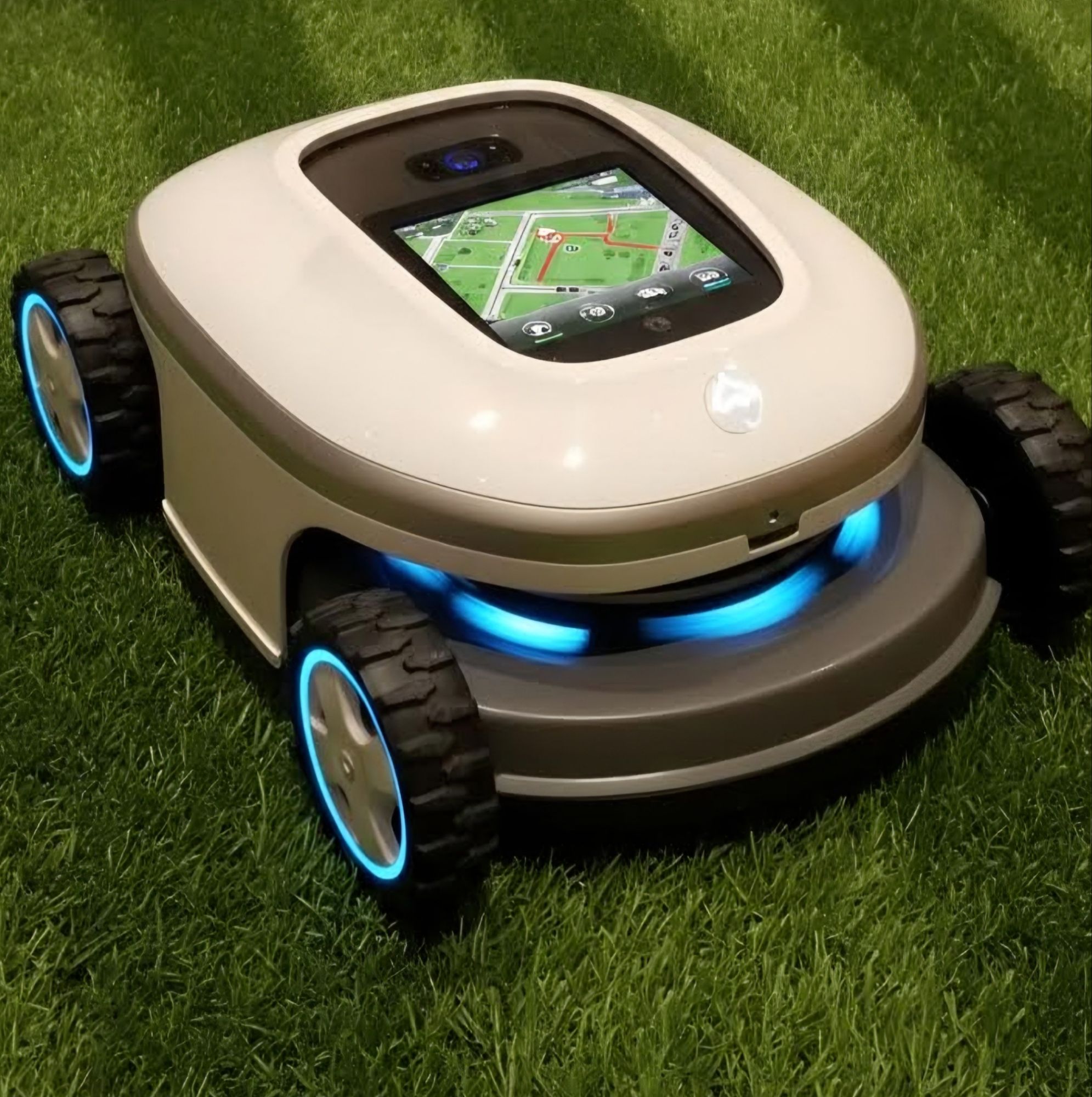
Integration with Mobile Apps and Digital Mapping Tools
Most robot lawn mower without perimeter wire now connect to mobile apps that show a live, digital map of your lawn. During setup, the mower drives around the garden to learn its boundaries, then sends that map to the app. You can edit the layout, rename zones, and mark special areas. Sunseeker Tech offers realistic app mapping, no‑go zones, and virtual boundaries, which makes it easy to protect flower beds, ponds, or play areas. You simply draw restricted zones on the map, and the mower updates its route instantly. The app also lets you schedule mowing times, track progress, and view coverage history. This integration turns navigation into a transparent, controllable system you can fine‑tune from your phone.
Conclusion
Wire‑free robot lawn mowers navigate by blending satellite data, sensors, and AI into one coordinated system. GPS and RTK keep the mower on track, while cameras, lasers, and ultrasonic sensors detect edges and obstacles with high precision. Intelligent path planning algorithms then transform that information into efficient, predictable mowing patterns. If your lawn has tricky borders, winding edges, or narrow passages, Sunseeker Tech stands out with 3D fusion sensing, 50 m laser detection, AI path planning, realistic app mapping, and no‑go zones. You gain tidy results, flexible control, and far less manual work. By removing physical wires, these robots make lawn care smarter, easier, and ready for changing garden layouts.