INTERACTIVE MAP FOR COVID-19

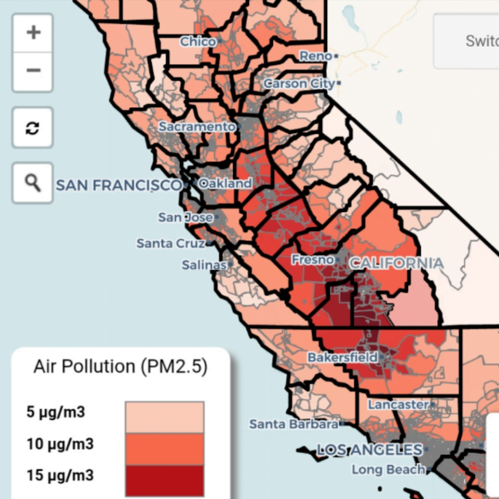
UC Berkeley shares a new interactive map they’ve created that allows you to zoom in on different regions of California to see the levels of certain particulate matter in the air revealed to increase the likelihood of dying from a COVID-19 infection.

The data would suggest that the San Joaquin Valley, which includes Fresno and Bakersfield, may be at particular risk, but all counties include areas with elevated levels of air pollution.

Their map also allows users to select a number of metrics to overlay each county. Users can choose to see the number of coronavirus cases (both per capita and in real terms) for each county, the number of deaths, the number of hospital beds, and other data that help tell a story unique to each region.

You can find more details about this project here.

Check this page for more maps, infographics, and other resources they’ve developed as part of their response to the crisis.

This entry was posted in UNCATEGORIZED and tagged , , , , , , , , , , , , on by .

About 360 MAGAZINE

360 MAGAZINE is an award-winning international publishing on popular culture and design. We introduce avant trademarks to efficacious architects. We are a LGBTQIA2S+ friendly publication--officially recognized by the NGLCC. Our core demographic ranges from 19 to 39-year-old college-educated trendsetters within their respective international communities. The pages in this art book satisfy their strong interests including music, art, travel, auto, health, fashion, tech, philanthropy, design, food and entrepreneurship. It's an introspective digital/print/tablet portrait series, which encapsulates artists/brands/entities who embody the true essence of our publication- empowerment, equality, sensuality and most important of all, humanity within a global society.

Connect with the Author

Leave a Reply